Among one of my groups of college friends, I'm the sole member who grew up south of the Mason-Dixon line, and occasionally get drafted as the official Southern Correspondent group to explain various Southern phenomena.
This week, the question was: why can't Atlanta deal with a dusting of snow? Is it incompetence?
The last time ATL was hit with a winter storm, there were four–FOUR–salt trucks at the ready. Two of them ran into each other on the way out of the lot, and reduced the road-clearing capacity of the city by fifty percent.
But the devil's-advocate response is that snow-clearance infrastructure in Atlanta has to go through a cost-benefit analysis, and that implies costs that have to get paid once in awhile. Maybe it was just a perfect storm of poor decision-making?
I've only been to Atlanta once, in the summer, so I can't speak to that. But my first instinct, coming from my experience as resident Southernologist among my Northern friends, is that the problem's not snow—it's ice, and ice in the South is actually worse than it is in the frigid upper Midwest.
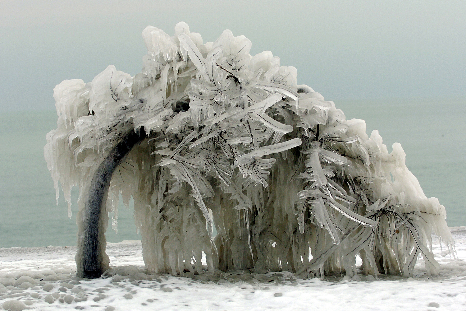
Growing up in the foothills of the Southern Appalachians, I actually dealt with much worse winter weather than I've ever seen in Chicago, in the form of epic ice storms. When I was 13, the 1994 winter ice storm covered parts of Mississippi in six inches of ice; the Blue Ridge Parkway, which runs a quarter-mile from the house I grew up in, saw 1,000 downed trees per mile. When I went outside to play basketball—we couldn't drive anywhere for days, so it was less insane than staying in the house for a school week—a 40-foot pine tree fell a couple car lengths away from the hoop. I watched the Winter Olympics on a 20-year-old portable TV, powered by batteries I lined up in sequence on the floor. We cooked on the woodstove.
But that's just intutition. What does the data show?
One of the problems with weather data is that good data doesn't go back very far, and it's especially bad with ice storms. But Stanley Changnon, a legendary Illinois meteorologist who started with the Illinois water survey in 1951 (he died in 2012 after a 61-year career), did some clever meteorological crate-digging in the early 2000s and came to a fascinating conclusion (emphasis mine).
Values of radial ice thickness measured on telegraph wires averaged between 0.6 (Northwest and upper Midwest) and 1.6 cm (South). Maximum ice values ranged from 3.9 (upper Midwest and Northwest) to 5.4 cm (South), and 75% of all ice thickness values were 2 cm or less. The various measures of ice thickness, as a measure of damaging conditions, reveal that the risk of damaging ice is greatest in the South and southern plains, closely followed by the threat in the Northeast and New England.
Up until the 1950s, railroads relied on telegraphs to transmit information. Those telegraph wires were at risk from ice, so the railroads began collecting data in a dense network of observation points over a nine-year period. That data ended up at Illinois during the 1950s as part of a broader study about weather and railroads, and Changnon put it to use in his study of ice storms.
Comparison of the frequencies of catastrophes and ZR [freezing rain] days in the six climate regions of the eastern two-thirds of the United States revealed some interesting regional differences. For example, a much higher state ratio, 3.5 ZR days per catastrophe, existed in the South than in the East North Central region, where the ratio was 25 ZR days per catastrophe. That is, relatively more ZR days in the South became catastrophes. This situation results from major regional differences in the primary storm-producing conditions. For example, the South has very low frequencies of ZR days, but storm-producing conditions persist a relatively long time and result in large ice deposits. The northern plains and upper Midwest have frequent freezing-rain days, but their property losses due to ice storms are low, a result of short-duration storms and low values of ice thickness on wires.
In other words, ice storms in the South are uncommon, so people have less experience with them and less incentive to prepare rarely-used infrastructure for it. But when they do come, they're worse. It's a bad combination from a public-policy perspective, which you can see in Mayor Kasim Reed's reaction—he didn't want to be the one "crying wolf" if the situation was normal instead of SNAFU.
What happened in Atlanta was not properly an ice storm (on the other hand, Birmingham got 1.25" of sleet), but the conditions were conducive to the freezing of wet snow. A Raleigh meteorologist pointed out that the Atlanta situation was similar to a dusting of snow that crippled that Southern city (via Eric Holthaus):
Still a number of factors had to come together to produce 8 hours of gridlock from so little snowfall. Chief among them was the occasional bursts of moderate snow. Though the bursts occurred only several times during the 2.5 hour snowfall period, they did feature larger flakes which efficiently coated the roads. During the period of light snow, the very small and dry flakes had simply been blowing across the roads. Once the snow was on the roads, the impact of heavy traffic was realized. Vehicles clogging the primary roads in a mass exodus of the city compacted the light coating into an icy composition which lead to numerous accidents and more gridlock.
Atlanta is a sprawling city with mediocre public transit, so it's hard for people to mode-shift. When the snow started falling during the middle of a business day, the influx of traffic likely made the conditions worse, as described above; research suggests that the heat from cars can contribute to freeze-thaw cycles on the road. In that sense, infrastructure, politics, and culture interacted with typical weather patterns to create a mess.
As Holthaus puts it, "extreme weather isn't always about extreme numbers." In the South, extreme weather can be generated from small numbers—the fine line between snow, slush, and ice.