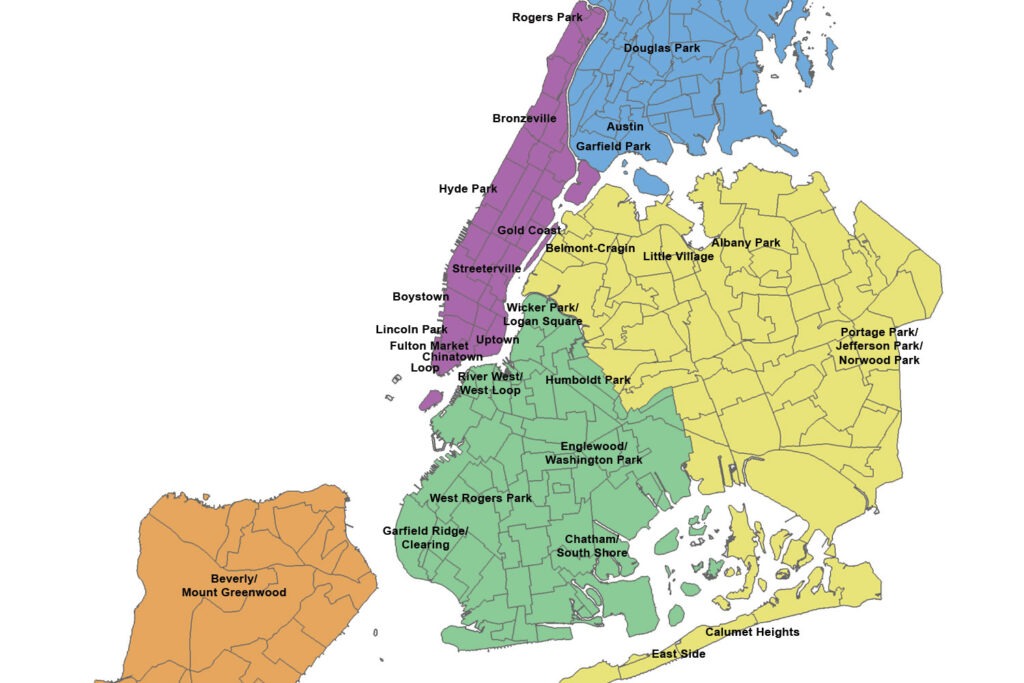
You may have seen that map, “A New Yorker’s Guide to Chicago.” It attempts to superimpose the five boroughs of New York City onto their analogues here in our city. Manhattan is the lakefront, Brooklyn is the Northwest Side, Queens is the Bungalow Belt, the Bronx is the South Side, and Staten Island is the Southeast Side.
The map was actually drawn by a Chicago illustrator, Frank Okay, who is married to a New Yorker. It may have been an artistic attempt to combine the two cities — Okay knows best — but it reminded us of this famous New Yorker magazine cover: a piece of evidence that New York is so provincial it can’t understand any other city unless that city is rendered in New York terms. Well, we can be provincial here in the Second City, too. Here’s a “Chicagoan’s Guide to New York City” map that will help you understand where you’d fit in in NYC. Chicagoans think in terms of neighborhoods, and we have 77 of those, compared to just five boroughs, so we tried to be more granular, to appeal to local sensibilities. And also to one-up New York.