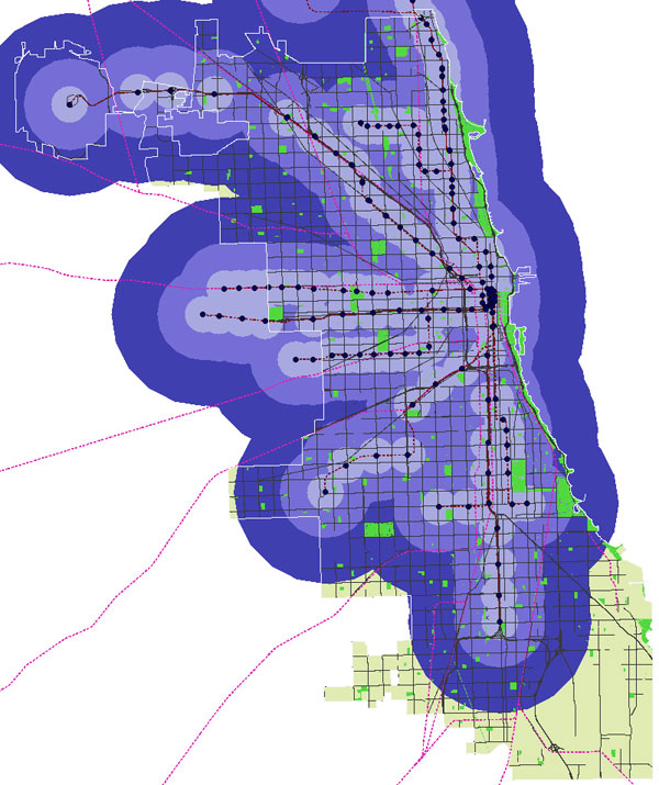
This warms my heart: my college friend Moacir de Sá Pereira, using data from one of my favorite local bloggers, Steven Vance of Steven Can Plan, mapped the city's el stops in order to show the system's coverage. The first map shows distances of one kilometer (.62 miles), two and half kilometers (a mile and half), and five kilometers (a little more than three miles). In other words, a short walk, a decent walk, and a long walk or bus ride.
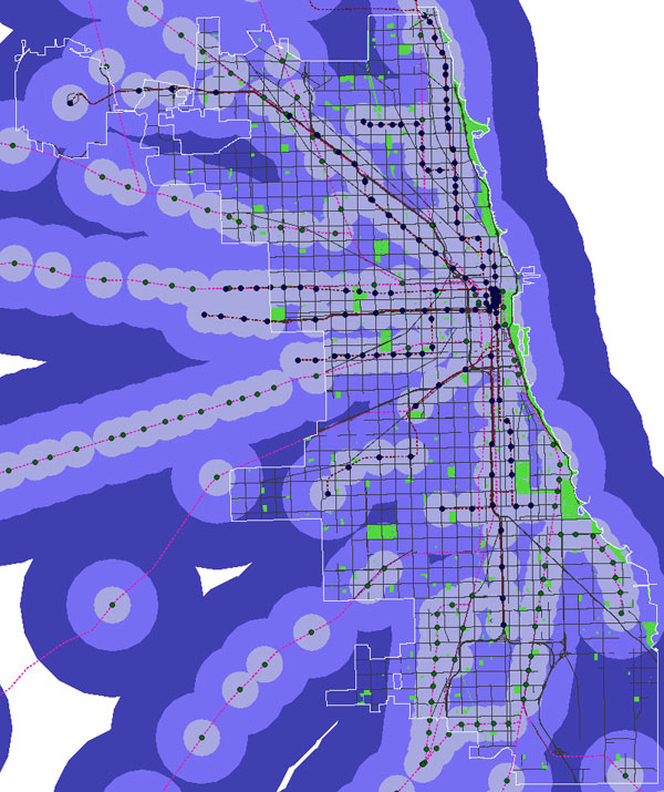
The second map includes Metra stops:
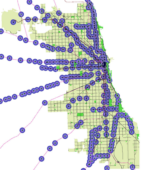
And the third is el and Metra stops with different perimeter sizes: 200 meters (about one-fifth of a mile), 500 meters (about a quarter of a mile), and 700 meters (less than half a mile).
He made that map in order to compare it to his current home of Paris, where the Metro coverage is extraordinarily dense:
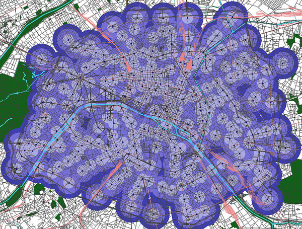
Which is exceptional. As he writes, "Anecdotally, I have felt since moving to Paris that one is never, ever too far from a Métro station. This is in contrast with Chicago, where one can be literally over a mile from an El stop…. [O]ne can assert with confidence that there’s nearly no chance that one lives more than 700m from a Métro stop in Paris."
Obviously Paris is a different type of city: smaller (40 square miles compared to 234) and much more dense (53,890 people per square mile compared to 11,864). But the city also has more than twice as many Metro stations as Chicago has el stops, 300 stations serving 14 lines, compared to 144 and 8. We're more dependent on buses: Chicago has 140 bus routes to Paris's 59. Perhaps as a result, public transit use in Chicago ranks well behind Paris, despite the city's larger population. The question, as always, is which is the chicken, and which is the egg.