A couple weeks ago I did a post on how the Chicago accent followed both lines of transport and lines of ideology—north along the Great Lakes and canals, centering in Rust Belt and Midwestern industrial cities. Today a friend (h/t ALM) sends me a wonderful map of the Midwest that overlays late 19th-early 20th century railroad lines with 2008 presidential election voting by precinct:
As part of ongoing work on a book manuscript, I am trying to understand the relationship between 19th and early 20th century industrialization patterns, the long-term evolution of urban form, and the spatial distribution of partisanship today.
[snip]
The map reveals distinct Democratic corridors along 19th century industrial transportation routes. Note, for example, the rail corridors between Chicago and Detroit, or heading Northeast from Indianapolis or North from Cincinnati. The route of the Illinois and Michigan Canal linking Chicago and Peoria is also quite striking.
As the author, Stanford's Jonathan Rodden, points out, it seems obvious (big cities vote Democratic), but the pattern remains true on smaller scales: places like Kokomo and Logansport, Indiana are more Democratic than the areas surrounding them. In other words, it doesn't take much to have a small urban Democratic area surrounded by Republican hinterlands. For instance, here's a parallelogram of rail that encompasses Logansport, Kokomo, Marion, and Wabash:
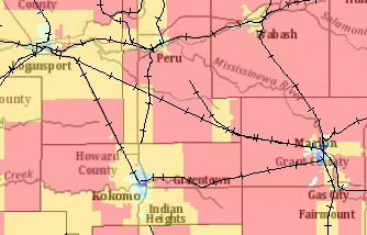
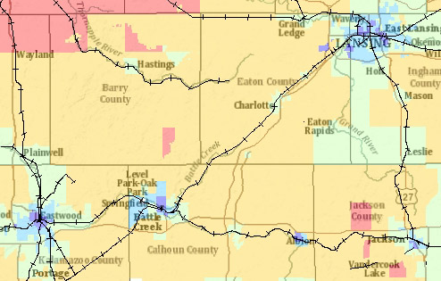
It's pretty red (six to 38 percent Democratic), but surrounding the junctions are little pockets of yellow (39 to 50 percent), green (51-63 percent), and blue (64-82 percent), though no purple (83-100 percent). Here's a similiar dynamic in Michigan, where blue and purple surround the junctions:
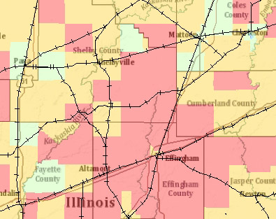
It's not a perfect correlation, but even in very red downstate Illinois, the pattern exists:
I'll be interested to see where Rodden goes with this: what combination of the flow of goods and information produces such ideological boundaries.