Twitter just blew up with news of an earthquake in Washington, DC. Well, technically not in DC, but near Mineral, Virginia, about equidistant from Richmond and Charlottesville. Since that’s near home for me, I immediately took an interest—because big earthquakes in my home state are rare, and because of the velocity with which information travels.
The 5.9 magnitude earthquake occurred at 12:51 local time. At about 12:52 or 12:53, I’d already noted that I’d gotten a stream of tweets about it. A minute later I’d already checked USGS and found nothing. A moment or two later I got an automated tweet from @NewEarthquakes informing me that USGS had been updated.
Then people in NYC started asking if there’d been an earthquake there. USGS didn’t have anything. So I started looking for similarly-sized earthquakes that had occurred in Virginia. Ten minutes after the Mineral quake, I found a USGS site about the most powerful earthquake in my state’s history, a 5.9 near Blacksburg in 1897.
Because science is awesome, the USGS had a link from that page to an isoseismal map of the 1897 earthquake. The link was broken, but thanks to the magic of Google cache (know your internets), I tracked it down:
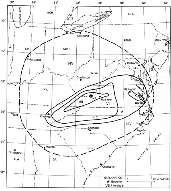
So if you’re in NYC and wondering why a big—but not enormous—earthquake located near Washington just shook your city, take the circles above and mentally shift them so that the epicenter is close to Richmond. It’s not quite that simple, of course, since the depth of the quake and the geology of the region will effect it differently*. But broadly speaking, there you go: why NYC just shook from the DC quake, within 20 minutes of it happening.
*Speaking of which, here’s why an East Coast earthquake affects more people than a West Coast earthquake:
Earthquakes in the central and eastern U.S., although less frequent than in the western U.S., are typically felt over a much broader region. East of the Rockies, an earthquake can be felt over an area as much as ten times larger than a similar magnitude earthquake on the west coast.
The rocks are old and cold and they carry the seismic energy very far. Even a magnitude 6 or less earthquake can be felt over a considerably large area, unlike California where the shaking is more concentrated.
So, yes, the Western U.S. does suffer many more earthquakes, but the shaking is limited to a smaller area.
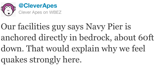
Update: On a local note, this is really interesting. Apparently people at WBEZ felt the earthquake, even though we’re well outside the distance you’d expect to. Here’s probably why:
Update II: Speaking of interesting metrics by which to gauge earthquakes, check out what they do to page load time.
Map: USGS/GPO