Via @paulsmith, the David Rumsey Map Collection—one of the largest private collections in the country—has a handful of maps online laid over current Google maps. It's a fun way to spend a couple hours, and one of the maps is an 1857 map of Chicago. I live near what used to be one of the largest private landholdings in the city, Thomas Suffern's massive plot, now Ukrainian Village:
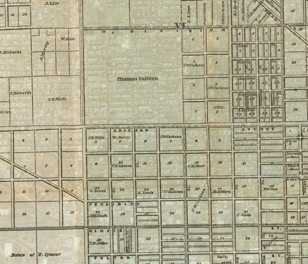
Basically, it's bounded by Chicago, Division, Western, and Damen, as bohemia gives way to brohemia. The 160-acre tract was undeveloped until well after the Chicago Fire, as the New York financier sat on it for decades, allowing locals to use it as farmland. Suffern remained in New York as a Washington Square society bigwig, one of the city's wealthier merchants.
Lincoln Park (the park itself, not the neighborhood) meanwhile, was mostly cemetary: a small Catholic one and the larger Chicago cemetary, the movement of which is explored in Pamela Bannos's wonderful "Hidden Truths" project.
Also notable: the structure for cab fares, 150-some years later, is basically the same, if considerably cheaper.
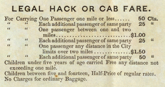
For a mile or less, that's about $12 (today it's about $4 for a mile), about $6 for an additional passenger (today it's $1), though there was no surplus charge to cover rising feed costs.