As part of David Bernstein and Noah Isackson's excellent piece on politicians and gangs in Chicago, we included a map of Chicago gang territory based on CPD information. Out of curiosity, I plotted 2011's homicides (through 12/11) and overlaid them on the gang-territory map. It's approximate, but it's a useful rough sketch of the overlap.
.jpg)
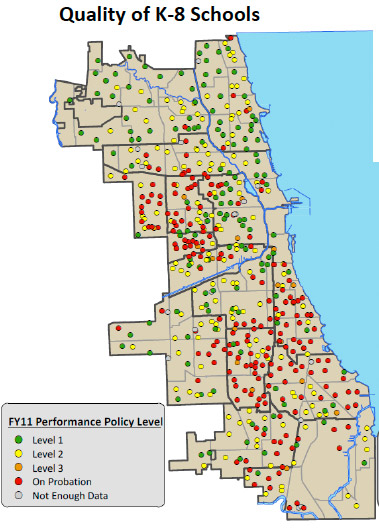
Update: @SethLavin makes the point that the above map correlates with CPS probation schools. It's true: