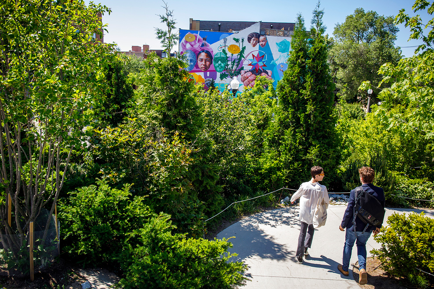
Back in July 2015, I wrote a long piece about the design of the 606, the linear park that runs on an elevated railbed from Wicker Park to Humboldt Park. As a regular user I've found it to have fulfilled its design goals: a "transportation corridor" filled with walkers, joggers, and cyclists at all hours, a West Side equivalent to the lakefront path. Though it adds some time to my commute, getting off of Milwaukee Avenue adds a bit of quiet to my day; until I started riding it, I didn't realize how much noise I was exposed to on a bike next to a passing stream of cars.
People designed it to do a thing, and it does that—sounds simple, but there's something satisfying about that. Still, it's coming at a cost.
You've probably read about housing prices along the 606. The Trib, for instance, in 2016: "The median household income east of Western Avenue was almost $116,000 from 2010 to 2014, according to the report. The median sales price for a single-family home in 2015 was $815,000." Or DePaul's Institute of Housing Studies from the same time, which worked with DataMade to find a 22 percent premium, about $100,000, for houses within two-tenths of a mile of the 606 on the trail's west end.
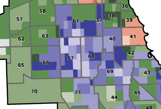
The IHS is back with a new report that maps out displacement pressures throughout the city. The area surrounding the 606, particularly the Humboldt to Logan stretch, isn't alone in seeing price increases in a neighborhood of modest incomes, but it contains three of the five census tracts in the whole city that combine high prices, significantly rising prices, and a substantial population of residents vulnerable to that combination. A fourth is just a stone's throw away, in Logan Square between Palmer and Armitage west of Central Park. The last one is the area surrounding the relatively new Stroger Hospital, which has been the target of massive investment in recent years. As Crain's Dennis Rodkin notes, the 606 could be a harbinger of change for Pilsen as the Paseo is built: another bike path running through a gentrifying Latino neighborhood.
The area around the 606 created the headline numbers in the report, but on the other side of the spectrum is West Englewood. Only 24 out of the 790 census tracts in Chicago (three percent) have seen a decline in sales prices from 2012 to 2016. Almost every one is on the South Side, but the highest concentration is in West Englewood, with some spillover into Englewood and New City/Back of the Yards (only the lightest shades are areas that have seen a sales price decline):
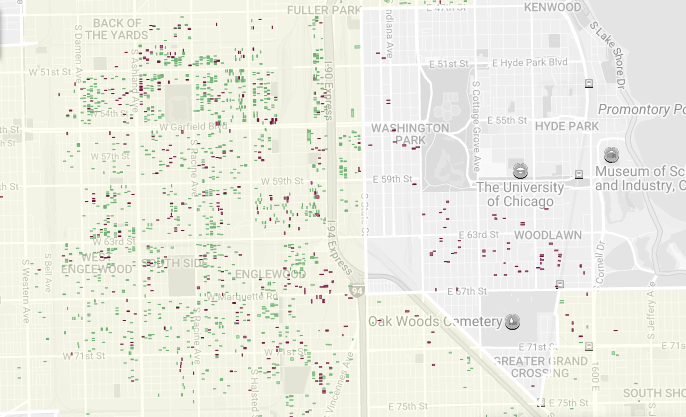
What's going on? Back in January, Rodkin reported on some mind-bending data from Chicago Cityscape: In 2016, West Englewood had the highest number of demolitions of any neighborhood in Chicago, about a third more than West Town. In Chicago's wealthier neighborhoods, demolitions are outpaced by new construction. But West Englewood had just two new construction permits. This is on the heels of it losing 22 percent of its population from 2000 to 2010; by 2015, 26 percent of its housing stock was vacant, about twice the citywide average. Englewood is comparable: It lost 24 percent of its population with a 36 percent vacancy rate. It's also where the city's Large Lots program has been doing the bulk of its work (each rectangle is a vacant lot that is available or has been sold):
While the vast majority of Chicago's census tracts have seen their housing values remain stable or rise (671 out of 790), Englewood lags. As South Side Weekly reported in a thorough investigation, it's the long shadow of the housing crisis, keeping the neighborhood in the shade as much of the city heats up.