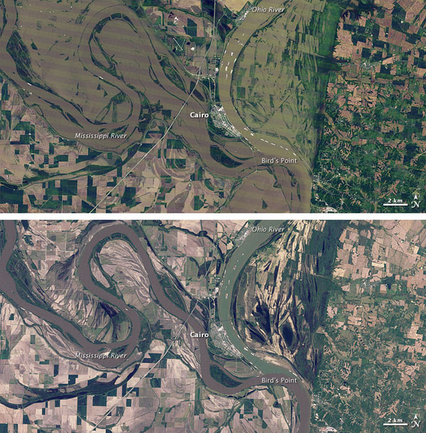
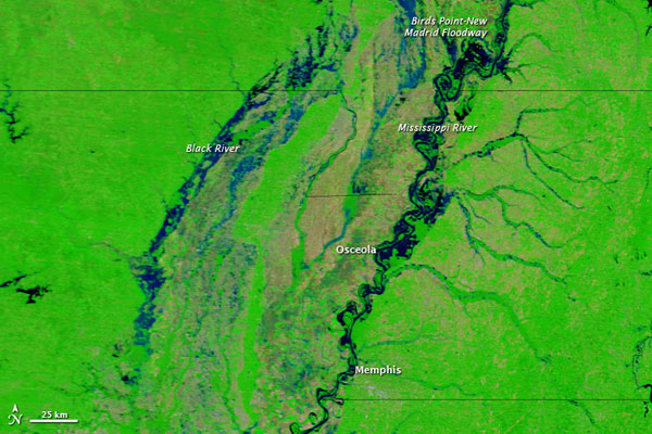
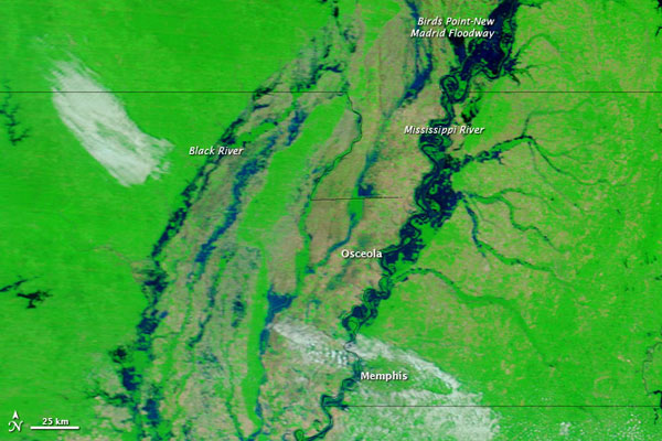
All eyes are on the Mississippi River as it reaches record levels in Missouri; the Wall Street Journal has a good interactive chart of flood gauges throughout the Midwest and South. For an overhead look at the extent of the flooding, this time-lapse video from NASA shows how the water has spread out from the confluence of the Mississippi and the Ohio near Cairo:
Here’s a still photo to get your bearings (top is May 3, bottom is April 14, 2010):
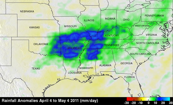
And in an entirely different sort of timelapse, here’s this spring’s wet weather visualized:
The Ohio is also flooding; here’s a satellite image of Mt. Vernon, Indiana, near the Indiana/Illinois/Kentucky border:
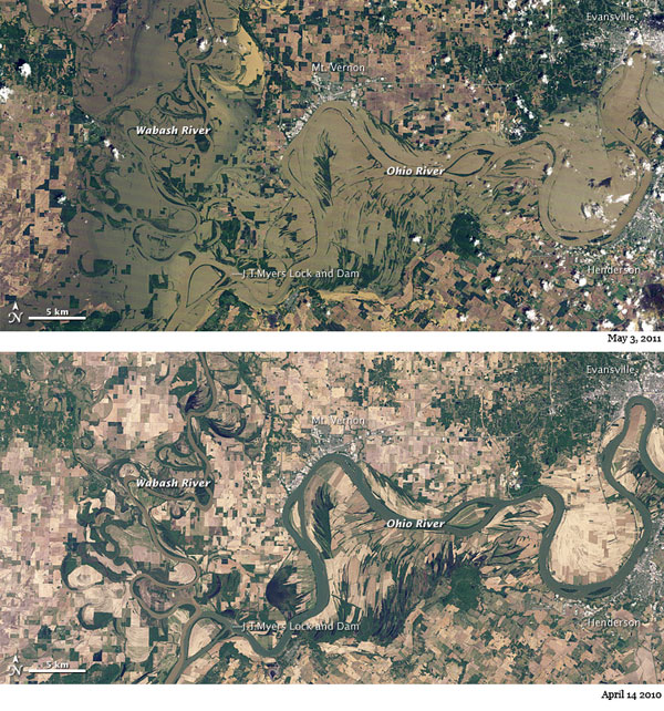
And the rising waters, as viewed April 29 and May 8 of this year:
 d
d
Photographs: NASA