Despite a four-state buffer between Chicago and the Atlantic Ocean, Sandy will affect weather patterns in Chicago. The National Weather Service issued a lakeshore flood warning for Lake Michigan that will be in effect from 1 a.m. Tuesday until 4 p.m. Wednesday. Waves fueled by Sandy’s winds could increase in size quickly by Monday night, National Weather Service meteorologist Richard Castro warned.
The Cook County coastline will likely see waves of 16 to 22 feet. A typical windy day in Chicago might bring waves of 4 to 6 feet, Castro said.
Here's how. First, via the spectacular Wind Map site, what the current wind patterns look like right now:
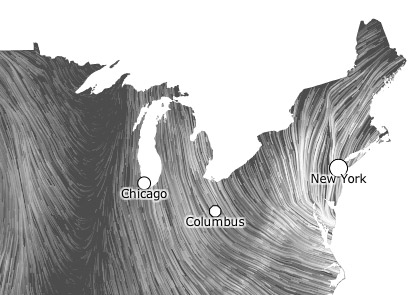
So the wind is just blowing Lake Michigan down towards us. Right now we're just on the border of the nor'easter part of the storm* that's driving moist air down from the Arctic:
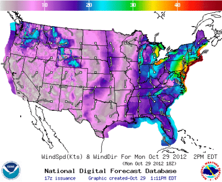
We might not get that much wind here, but it's going to just keep blowing down Lake Michigan. Here's the NOAA wind-speed forecast for right now, 8pm today, 2pm tomorrow, and 8pm tomorrow:
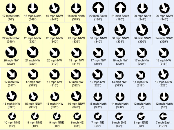
The rotation of the storm will do crazy stuff to the winds here (via Weather Underground); here are the forecasts for the next few days (each row is one day):
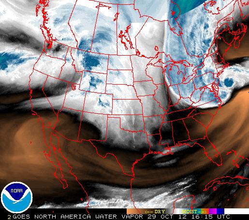
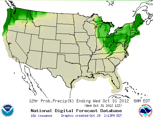
We're remarkably close to the bad weather Sandy is creating, but it's unlikely we'll get much, if any, precipitation out of it. Here's the precipitation forecast for tomorrow night through Wednesday morning, which shows just how close we are to the edge of Frankenstorm:
A meteorologically mind-boggling combination of ingredients is coming together: one of the largest expanses of tropical storm (gale) force winds on record with a tropical or subtropical cyclone in the Atlantic or for that matter anywhere else in the world; a track of the center making a sharp left turn in direction of movement toward New Jersey in a way that is unprecedented in the historical database, as it gets blocked from moving out to sea by a pattern that includes an exceptionally strong ridge of high pressure aloft near Greenland; a "warm-core" tropical cyclone embedded within a larger, nor'easter-like circulation; and eventually tropical moisture and arctic air combining to produce heavy snow in interior high elevations. This is an extraordinary situation, and I am not prone to hyperbole.
Hurricane Sandy and the nor'easter are basically two giant gears turning, and we're right on the border.