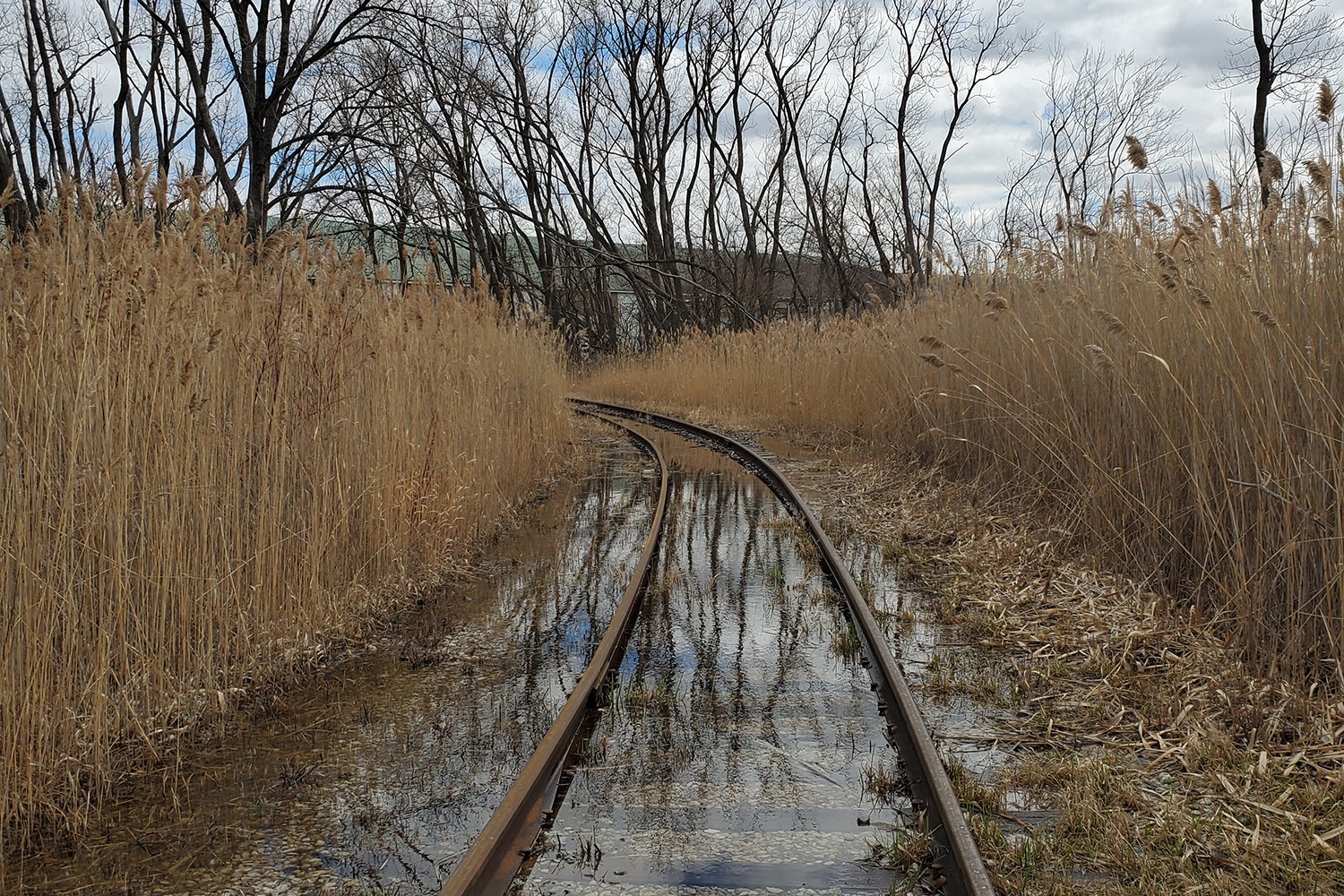
To reach the southeasternmost corner of Chicago, you have to take bumpy, potholed Boy Scout Road out of Hegewisch, then turn onto a set of tracks belonging to the Indiana Harbor Belt Railroad. With Powder Horn Lake to your right, follow the tracks between tall stands of reeds, still in their winter blondeness, toward a railyard where black tankers idle. Then turn onto a disused rail spur, weeds growing between its ties. Ahead, just across the state line, in Hammond, Indiana, are the rusted sheds of some long-abandoned industrial concern.
Chicago’s southern border is, perhaps, the wildest, most undeveloped part of the city, a hinterland that, in some places, looks more rural than urban, despite lying within the boundaries of America’s third-largest city. Like the nation’s southern frontier, it is a no-man’s land that crosses woods, lakes, rivers, and federal facilities off limits to the public. It would have made sense to set the southern city limits at the Little Calumet and Grand Calumet rivers. Instead of respecting natural boundaries, though, surveyors drew a straight line that corresponds with the middle of 138th Street and is often impossible to follow, even by bicycle or on foot. Last weekend, I tried, and, for most of its length, I failed.
After leaving the Belt Railroad yards, the city limits travel west across Powder Horn Lake and through Burnham Woods. I only had a bicycle, not a canoe or a machete, so I couldn’t paddle and bushwhack through those wild barriers. To pick up the line again, I pedaled south to the village of Burnham, and into the dirt alley behind 138th Place, a street of vinyl-sided workers’ cottages and a long-shuttered Old Style bar. Running along the north side of the alley is a fence entangled with vines — a border fence between the city and suburbs, as flimsy as any in the Sonoran Desert, barring the way to Mexico. On the other side is Chicago.
The alley dead ends near the south bank of the Grand Calumet River, the body of water that lends its name to the Calumet Region. From there, the city limits cross the confluence of the Grand and Little Calumets. When they hit land again, they slice through the northern tip of Burnham Park. A few square feet of that suburban park actually lies inside Chicago, although the village of Burnham still mows the grass. Such is what happens when man’s Euclidean determinations impose themselves on nature’s beguiling irregularities.
Between the Little Calumet River and the Bishop Ford Freeway, the city limits are inaccessible, because they cross land belonging to the Army Corps of Engineers, which maintains the O’Brien Lock and Dam. Chicago became a significant Native American settlement, then a great city, because of its position astride the watershed between the Great Lakes and the Mississippi Valley, the continent’s most important systems of water transport. The O’Brien Lock is the man-made transfer point between the two systems, enabling barges that travel up the Cal-Sag Channel to enter Lake Michigan.
The closest I could get to the O’Brien Lock was 130th Street, a mile north of the city limits. Here are a couple tips for Chicago cyclists: One, don’t ride on 130th Street. Two, don’t get a flat tire there — especially if you live 195 blocks away. I pedaled past the Ford Motor Co.’s Torrence Avenue plant, which builds the Explorer, every police department’s favorite SUV. There is no bike lane on 130th Street. A bicycle there feels as flimsy and out of place as a Sunfish sailboat at the Battle of Midway. After a few near misses with pickup trucks under a railroad viaduct, I pulled my bike onto the sidewalk of an old bridge across the Little Calumet. (Old as in built during the mayoralty of Martin Kennelly, who served from 1947 to 1955.) The sidewalk was spangled with pebbles and broken glass, so when I pedaled away, it was with a punctured inner tube.
Related Content
I can imagine nothing more foolhardy than walking a bicycle across the interchange between 130th Street and Interstate 94. Doing so would invite a fatal collision with a distracted driver who was not expecting to see a stranded cyclist as he decelerated off the Bishop Ford at 55 miles an hour. As a matter of survival, I struggled forward on a flat tire until I reached the nearest settlement. That was Altgeld Gardens, a housing project of two-story townhouses built for World War II veterans. I locked my bike up in front of the library and continued on foot, which turned out to be a fortuitous necessity.
I had always believed Altgeld Gardens to be Chicago’s southernmost neighborhood. I was wrong. There are Chicagoans living south of Altgeld. In search of the river, I followed an oiled road that runs behind Haskins Chicago International Charter School, past Peter Rock Church of God in Christ. In the woods, obscured by branches, was a green sign for 134th Place. On this block were two brick houses backing up to the river, and then a third house, surrounded by old vehicles, including an RCN van and a cruiser bearing the peeled-off markings of the Truth or Consequences, New Mexico, Police Department. As I walked past, dogs barked warnings from behind a wooden fence. I hurried away from this country scene, toward the urban world of Golden Gate. I knew I was far south, but not in Shawneetown.
And yet, there is even more of Chicago beyond the river. At Indiana Avenue, I unlocked a Divvy e-bike and rode it across the metal bridge, into the only city neighborhood south of the Calumet. Just four blocks long and eight blocks wide, it’s surrounded on the west by Riverdale, on the south by Dolton, on the north by the river, and on the east by River Bend Prairie, a grassed-over landfill punctured by natural gas wells. At 138th and Leyden is St. Mary Catholic Church, built in 1956, abandoned by its dwindling congregation in 2011. A stone bas-relief of the Virgin spreads her hands above doors no longer opened. Further down the street are the Seashells Yacht Club (“Where the Water Meets the Heart” / Members Only), and the Pier 11 Marina, which is up for sale.
On 136th Street, Walter Perez was leaning under an open hood, working on his truck’s engine. Perez has lived for 20 years in this quiet neighborhood that’s south of the South Side. Although it’s part of Chicago’s Riverdale community area, he says, most people think it’s in the adjacent suburb of Riverdale, with which it shares the 60827 zip code. The cops know better.
“There was a fight over there,” Perez said, pointing across Indiana Avenue. “They came over to this side. Someone called the Riverdale police and they said, ‘No that’s in Chicago.’”
Because “there’s no restaurants or mechanics or banks” in the neighborhood, everyone shops on Sibley Boulevard in Dolton. Life there is suburban in every respect but the tax bills and the mailing addresses.
“This is the end of Chicago,” Perez said. Then he looked at me. “When I saw you coming down the street, I thought, ‘He’s lost.’”
I wasn’t lost. I’d found exactly what I’d been looking for.