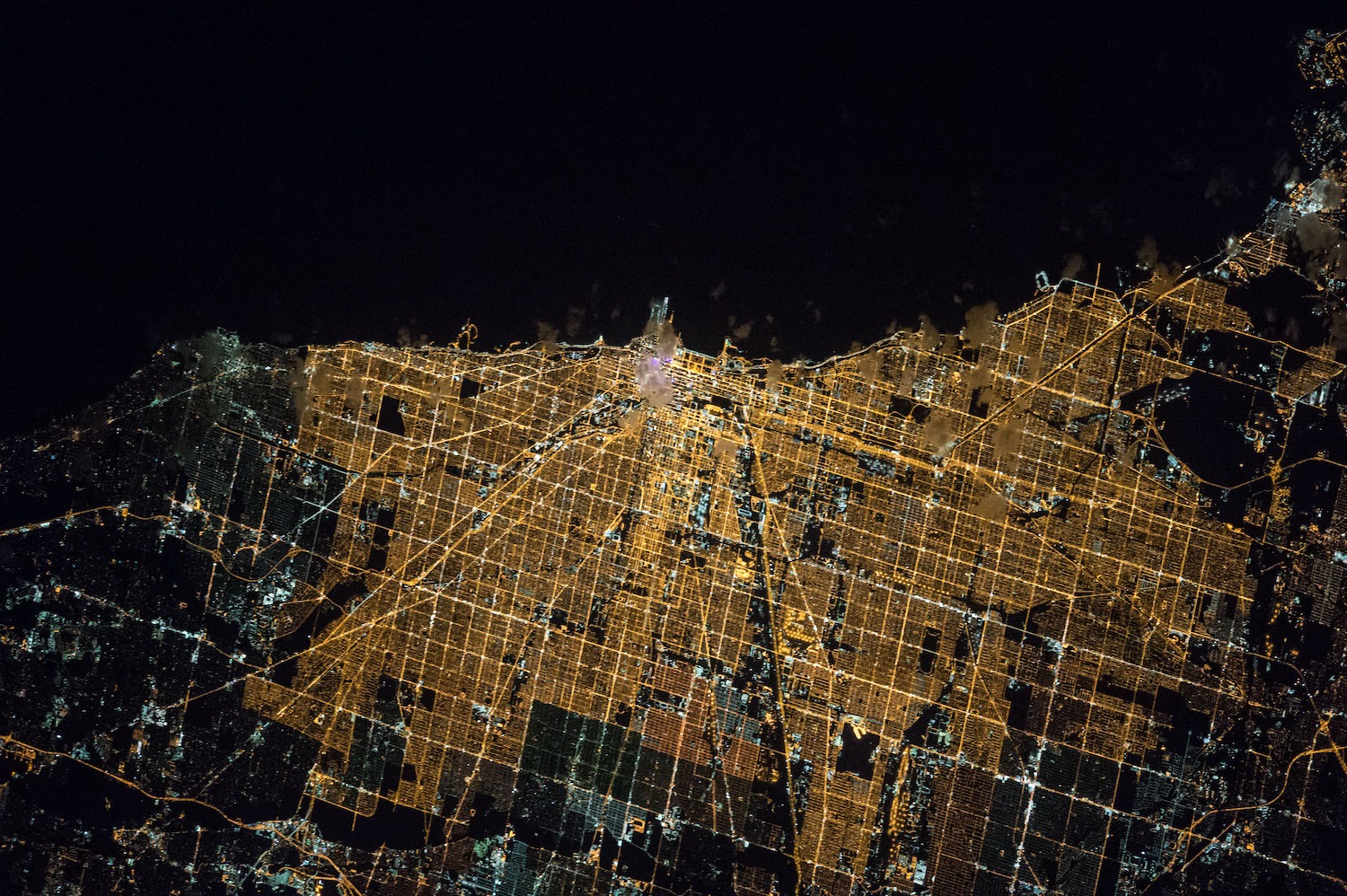
I was flying into O’Hare one night, sitting next to an electronics salesman. As the plane passed from the blankness of Lake Michigan, we looked out the window at a perfectly ruled network of glowing orange streetlamps—illuminated squares repeating themselves toward the horizon in three directions.
“It looks like electronic circuitry,” I commented, and the salesman agreed.
It is right to compare Chicago’s street network to something so obsessively exact. A recent academic study, “Urban spatial order: street network orientation, configuration, and entropy,” by Geoff Boeing, looked at the maps of 100 major world cities, and found that Chicago’s “exhibits the closest approximation of a single perfect grid.” Nowhere else have urban planners been so successful in imposing Euclidean order on natural surroundings. On a scale of 0 to 1, in which 1 is a perfect grid, Chicago scores 0.9. (The least-perfect grid is Charlotte, a Sunbelt city whose street system is more entropic than Rome or São Paulo.)
Why are Chicago’s streets such a near-perfect arrangement of 90-degree angles? The reason has to do with both Midwestern practicality and commerce. The values that shaped us as a city also shaped the streets on which we walk and drive.
Chicago’s grid system dates back to 1830, making it even older than the city itself. At that time, wrote Alfred T. Andreas in his History of Early Chicago, “Chicago had but a mythical existence, the name applying sometimes to the river and again to a cluster of cabins along its marshy shores or sandy banks.” However, Congress had recently granted land to Illinois for the construction of what would become the Illinois & Michigan Canal, linking the Great Lakes with the Mississippi River system. The state decided to lay out towns along the prospective route, and sell lots to pay for the canal.
The man hired to plat a town at the mouth of the Chicago River was James Thompson, a surveyor from Kaskaskia, and the father of the Chicago Grid. Illinois had already been divided into square townships and sections by the Northwest Ordinance of 1785. Since Thompson was subdividing a township section, he simply repeated that pattern in miniature when he designed Chicago’s first street map. It was less than half a square mile, bounded by Kinzie on the north, Washington on the south, Jefferson on the west and Dearborn on the east, but it was the template for a network that would eventually cover the 234 square miles of Chicago—and extend into suburbs beyond its borders.
August 4, 1830, the date Thompson published his plat, “marks the birthday of Chicago as a town, and the ‘Fort Dearborn settlement’ disappeared,” Andreas wrote. It was the moment Chicago ceased to be a wilderness outpost and became a city for sale. That’s Chicago.
The settlement soon got snapped to the grid like Legos. According to Ann Durkin Keating, a historian at North Central College, “By the Greenville Treaty of 1795, a parcel of land at the mouth of the Chicago River was ceded by Native Americans to the U.S. government, so that as Chicago grew up around Fort Dearborn, no one could own land there. It became real estate only with the arrival of the grid. Early Chicago town and city governments required people to move their buildings off of streets and onto the grid real estate lots during the 1830s. So any buildings that preceded the 1830 arrival of the grid were moved onto the grid.”
Thompson’s grid was interrupted only by the river, and by established Native American trails which became diagonal streets: Elston, Clark, Milwaukee, Archer, Ogden. By 1869, the grid had become so integral to the city’s identity that the Tribune boasted, “There is no city where the opportunities for straight streets are so advantageous as in Chicago,” and demanded, “Give us straight, broad streets, running uninterruptedly from one extremity of the city to the other.”
As the Encyclopedia of Chicago notes, the grid enabled Chicago to become the fastest-growing city in the nation in the 19th Century, because “[p]lats could be quickly and cheaply drawn, few irregularities needed to be accommodated, and when Chicago annexed adjacent areas, the parts of the jigsaw fit into the whole with little adjustment.”
(The grid also enabled Chicago’s simple numbering system, which was adopted in 1901, with eight blocks, or “hundreds,” equaling a mile. It’s really easy to get around here, even without MapQuest.)
In our quest for orderliness, Chicago also has the advantage of being one of the flattest cities in the U.S., lying on a plain that was once the bottom of a proto-Great Lake. It would not be practical or possible to impose an uninterrupted grid on Pittsburgh or San Francisco, where streets wind sinuously around hills. As the study notes, “Boston features a grid in some neighborhoods like the Back Bay and South Boston, but they tend to not align with one another. Furthermore, the grids are not ubiquitous and Boston’s other streets wind in various directions, resulting from its age (old by American standards), terrain (relatively hilly), and historical annexation of various independent towns with their own pre-existing street networks.”
Squareness has always defined Chicago as a city, both figuratively and literally. And it would go on to define itself through the Chicago School of sociology, the foremost theoretical model of twentieth century city growth and development in urban studies, which tried to find order of all kinds in cities around the world. “The World’s Most Spatially Ordered City” is perhaps not as romantic a title as “The City of Light” or “The Holy City,” but we’ll take it.
Comments are closed.