As the rain finally abates in Houston, attention is turning to what other cities are doing to prepare for major floods. Hurricane Harvey generated a literally historic rainfall that no city can be expected to fully absorb—one-sixth of Lake Erie's total volume. But climate change will likely increase the severity of rainstorms, as Eric Holthaus writes, so even cities that have been improving their wastewater infrastructure for decades are rushing to catch up.
The story of Chicago is basically one of water management. As far back as the 1600s, explorers realized that its location would be ideal as a shipping hub, as long as the Great Lakes could be connected to the Mississippi River via canal. That eventually happened; the city grew at an explosive rate, and managing its freshwater, stormwater, and wastewater led to some of the greatest civic engineering projects ever attempted, even if their reach typically exceeded their grasp.
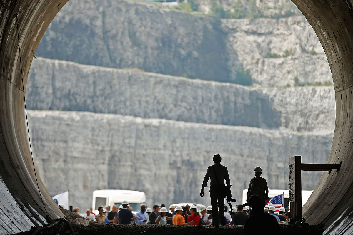
Chicago's primary effort to control flooding is another one of those epic engineering projects: Deep Tunnel, officially known as the Tunnel and Reservoir Plan or TARP, almost 110 miles of underground wastewater tunnels feeding into billions of gallons' worth of reservoirs. By 2029, or 57 years after the plan was settled upon, the total storage of the system will be 17.5 billion gallons.
By contrast, the volume of Harvey's rainfall over five days is estimated to be 20 trillion gallons. Deep Tunnel couldn't handle that; there's also evidence that it cannot, on its own, handle a large storm by Chicago standards. In 2010, meteorologist Stanley Chagnon calculated that the record rainfall of September 13, 2008, generated 469 million square meters of water over 24 hours, which translates to 124 billion gallons. This was a one-in-50-year storm—a confusing metric, so here's a good explainer in Vox on how it's calculated and what that probability means—but the short of it is that there's a two percent chance of such a rainstorm occurring each year. There's debate about how realistic those probabilities are, and whether they could change along with the climate.
Chagnon concluded:
The magnitude of the September 2008 storm and the use of diversions of flood waters into Lake Michigan and the Illinois River illustrate what will be needed when major rainstorms occur at other large cities. They should be prepared under heavy rainstorm situations to divert stormwaters into an adjacent lake, an oceanic body, and/or a large adjacent river system.
The September storm reveals the large and costly deep tunnel-reservoir system in Chicago is not adequate to handle the magnitude of water produced by rainstorms that create 6- to 24-hour amounts having once in 50-year or greater frequencies and extending over several hundred square kilometers. Lowering the river system by added inflow to the Illinois River before a rainstorm strikes the area will help but is not sufficient to handle waters generated by more major storms. Thus, future major rainstorms in the Chicago area will require sizable releases of water into Lake Michigan to minimize flooding in the city.
That conclusion has held. As the Tribune's Michael Hawthorne has reported over the years, and as recently as this June, rainstorms regularly exceed the system's capacity, causing overflows into the Chicago River. Chagnon points out that, in some ways, this is how the system is supposed to work (water is diverted into the river instead of flooding streets and basements) but it results in massive discharges of bacteria-laden wastewater into a river that's supposed to be turning into a recreational amenity.
The Chicago area has taken some interesting steps towards a more robust future of wastewater management. It has "green" alleys that reduce the flow of stormwater into the sewage system; bioswales and stormwater monitoring; at-cost rain barrels; tree pits, green roofs, and more. But in the grand scheme it's still at fairly small scale.
There are much bigger ideas on the drawing board. Many of those come from the mind of architect Jeanne Gang, whose work on Northerly Island speaks to the future of how the built environment transitions into the natural one. Her book Reverse Effect: Renewing Chicago’s Waterways argues for re-reversing the Chicago River and surrounding it with green infrastructure and natural forms of water treatment, rebuilding the divide between the Great Lakes and the Mississippi, and capping the era of civic engineering that built Chicago:
Meanwhile, the riverfront area around Bubbly Creek has a band of industrial land that could start to be acquired. It’s basically defunct. All the big industries down there are not coming back. Once that’s done, we would start to introduce green infrastructure: permeable pavement that allows storm water, which is not that dirty, to go straight down into the aquifer and back into the lake. Every time you redo a street, you upgrade it to the permeable pavement instead of solid. You also redesign the tree planters so that water is funneled to them from the street. It takes the water load off at the point source, instead of dumping fresh rainwater into the sewer system. All that would keep our basements drier.
[snip]
The next step is to take out the canal—which is a concrete basin—and remediate the area so it can start to operate like a wetland. Use nature as technology. The wetlands will increase the amount of waterfront, increase the amount of green space, and increase property values on either side of the river. Then start to invest in more water treatment. Instead of pumping sewage and the overflow into Stickney, you could just treat it here. We need to expand our wastewater treatment. Use biodigesters to clean the water basically and return it to the wetlands for the last polishing.
Being one of the world's most prominent architects, her ideas have gotten a lot of attention. More under the radar is the research of University of Illinois landscape architecture professor Mary Pat McGuire, which Zach Edelson covered last year for The Architect's Newspaper. McGuire's ideas are similar to ones the city and Gang have been working on—replacing paved surfaces with permeable ones—but she's identified underground sand deposits that could serve as natural reservoirs, and prioritizes the renovation of surface infrastructure where it will work best with what lies underneath. (Here's what one small piece of that plan would look like, between 86th Street and 88th Street on Stony Island Avenue.) Notably, a lot of that sandy soil is on the South Side, which has some of the city's most severe flooding problems. It's a more appealing way of storing water than another intriguing idea that's been floated: turning abandoned homes into cisterns.
Deep Tunnel, despite its size, can't carry the burden alone. Green-infrastructure supplements to TARP hold promise, but at best they're not far from the pilot stage, and the more transformative approaches are on the drawing board. There's hope, though: The city exists because of epic, technologically cutting-edge water management and its willingness to not let scale (or failure) stop its civic engineers.